Fault and Anomaly Characterization
 Download Case Studies
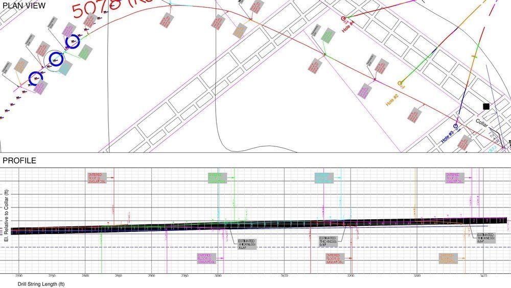
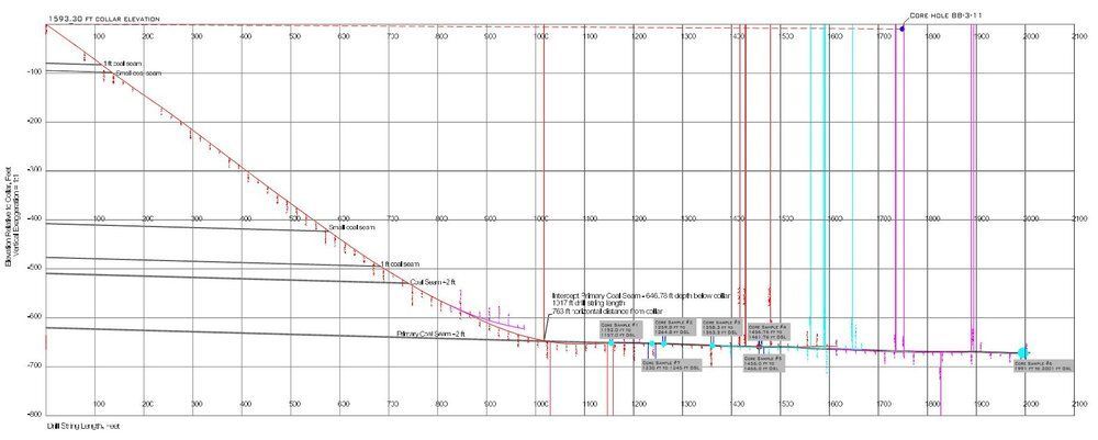
Directional holes provide a wealth of information about bedded deposits. REI uses directional drilling and sidetracking to maintain boreholes in the seam over distances up to 6,000 feet, and by plotting the profile of the borehole from downhole surveys and driller logs, REI provides the mining operation with an indication of seam structure along the full length of the borehole. Sidetracks are developed and intentionally drilled into the roof and floor rock at corresponding drill string lengths to compare elevation data to estimate the seam thickness.
Structure Characterization
Download Case StudiesVertical boreholes, such as historic gas wells in advance of mining developments, are often unable to be accessed from the surface. In these cases, horizontal drilling can be employed to verify the locations. REI can develop parallel horizontal boreholes on either side of a magnetic anomaly, and use a magnetic gradiometer to verify the vertical hole location with a high level of accuracy. This novel approach allows mines to locate objects such as vertical well casings, giving the confidence to continue development.
Geophysical Surveys and Geotechnical Drilling
Download Case StudiesREI uses directional drilling to gather geophysical data from hard-to-reach areas of mining operations that would not be possible with traditional non-directional techniques. REI can steer a borehole along a determined alignment and run a post-drilling geophysical survey, including continuous gamma, televiewers, and a range of other tooling. Additionally, REI can collect core samples and perform overcore stress tests to provide geotechnical data, as well as stress data points
Coal Quality Characterization
 Download Case Studies
Through sidetracking, directional drilling maximizes the amount of data gathered from each corehole while minimizing total footage drilled. Increased borehole design capabilities allow for optimal borehole placement and core retrieval. REI has experience from surface and underground setup locations, so call us for more information to see if directional techniques can improve your exploration program.
2 x Fletcher High Thrust Longhole Drills (2-part)
- > 40,000 lbf Thrust
- > 2,000 ft-lb Torque
- 5,000 ft, 3.8 inch diameter
- 3,000 ft, 6.0 inch diameter
- 4-4.5 ft H x 7-8 ft W x 16-18 ft L
- 480/575 VAC, 100 hp
3 x Fletcher High Thrust Longhole Drills (1-part)
- 50,000 lbf Thrust
- > 2,000 ft-lb Torque
- > 5,000 ft, 3.8 inch diameter
- > 3,000 ft, 6.0 inch diameter
- 4-4.5 ft H x 7-8 ft W x 16-18 ft L
- 480/575 VAC, 150 hp
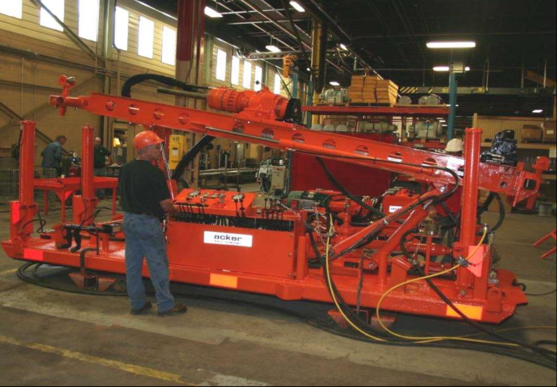
Acker Big John MPM Drill
- 30,000 lbf Thrust
- > 2,000 ft-lb Torque
- 3,000 ft, 3.8 inch diameter
- 2,000 ft, 6.0 inch diameter
- 3 ft H x 6 ft W x 18 ft L
- 480/575 VAC, 100 hp

2 x VLI 1000 Longhole Drills
- 50,000 lbf Thrust
- 3,000 ft-lb Torque
- 5,000 ft, 3.8 inch diameter
- 3,000 ft, 6.0 inch diameter
- 5 ft H x 6 ft W x 18 ft L
- 480/575 VAC, 120 hp
2 x VLI 3000 Extended Reach Drills
- > 125,000 lbf Thrust
- > 5,500 ft-lb Torque
- + 8,000 ft, 3.8 inch diameter
- + 5,000 ft, 6.0 inch diameter
- 7 ft H x 6 ft W x 18 ft L
- 950 VAC, 300 hp
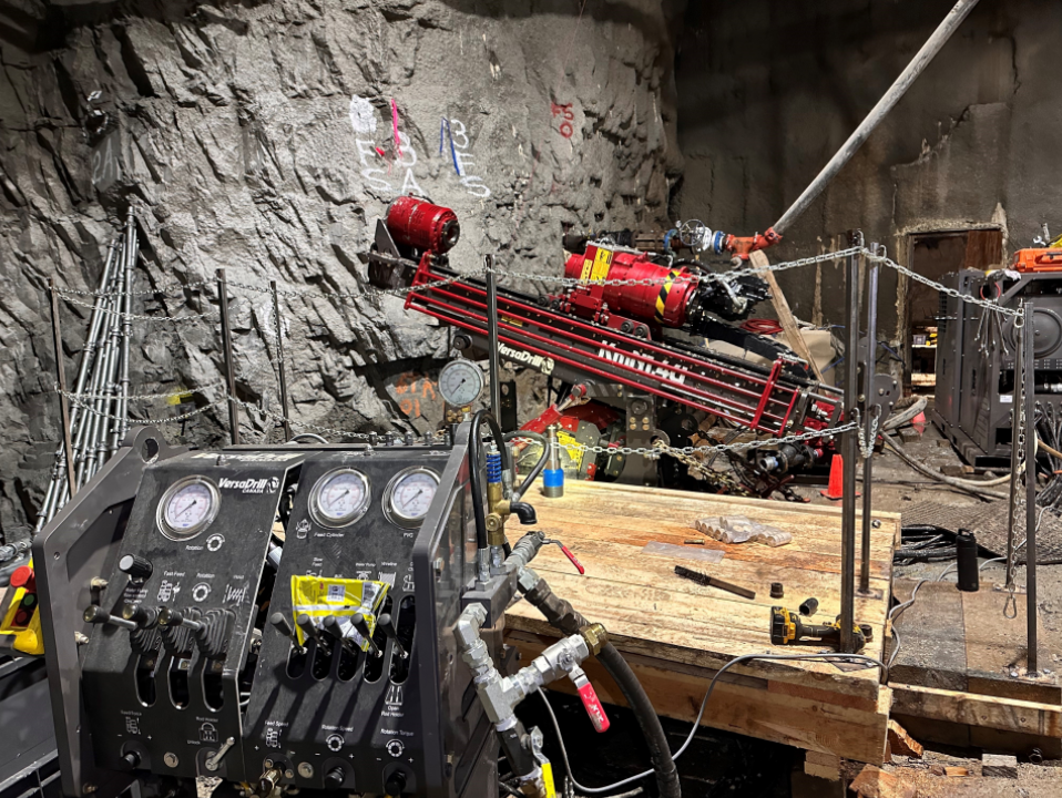
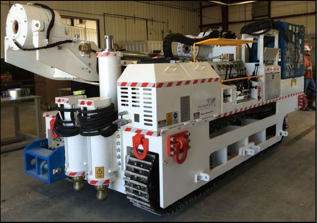
2 x Versadrill KmN1.4U Underground Drills
- > 25,000 lbf Thrust
- > 4,100 ft-lb Torque
- + 3,000 ft, 3.8 inch diameter
- + 1,500 ft, 6.0 inch diameter
- 6.5 ft H x 5 ft W x 13 ft L
- 480 VAC, 125 hp
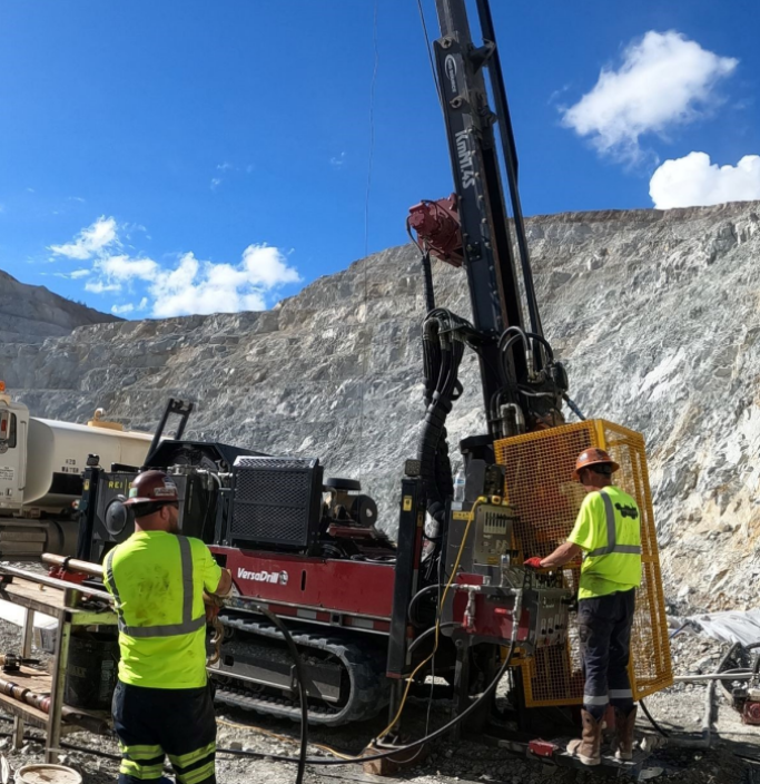
1 x Versadrill KmN1.4S Surface Drill
- > 38,000 lbf Thrust
- > 4,100 ft-lb Torque
- 4,000 ft, 3.8 inch diameter
- 2,000 ft, 6.0 inch diameter
- + 9 ft H x 7 ft W x 21.5 ft L
- 250 hp Tier 3 Diesel
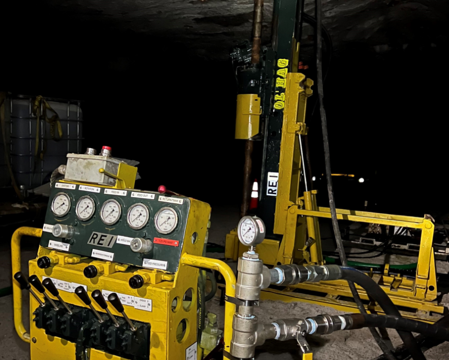
1 x Hagby Onram 1000 Drill
- 15,000 lbf Thrust
- 1,400 ft-lb Torque
- + 2,000 ft, 3.8 inch diameter
- 3.5 ft H x 2 ft W x 10 ft L
- 480 VAC, 60 hp